Select Stations to Find Your Route
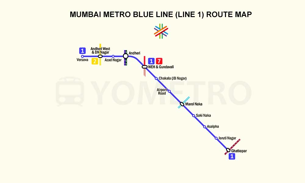
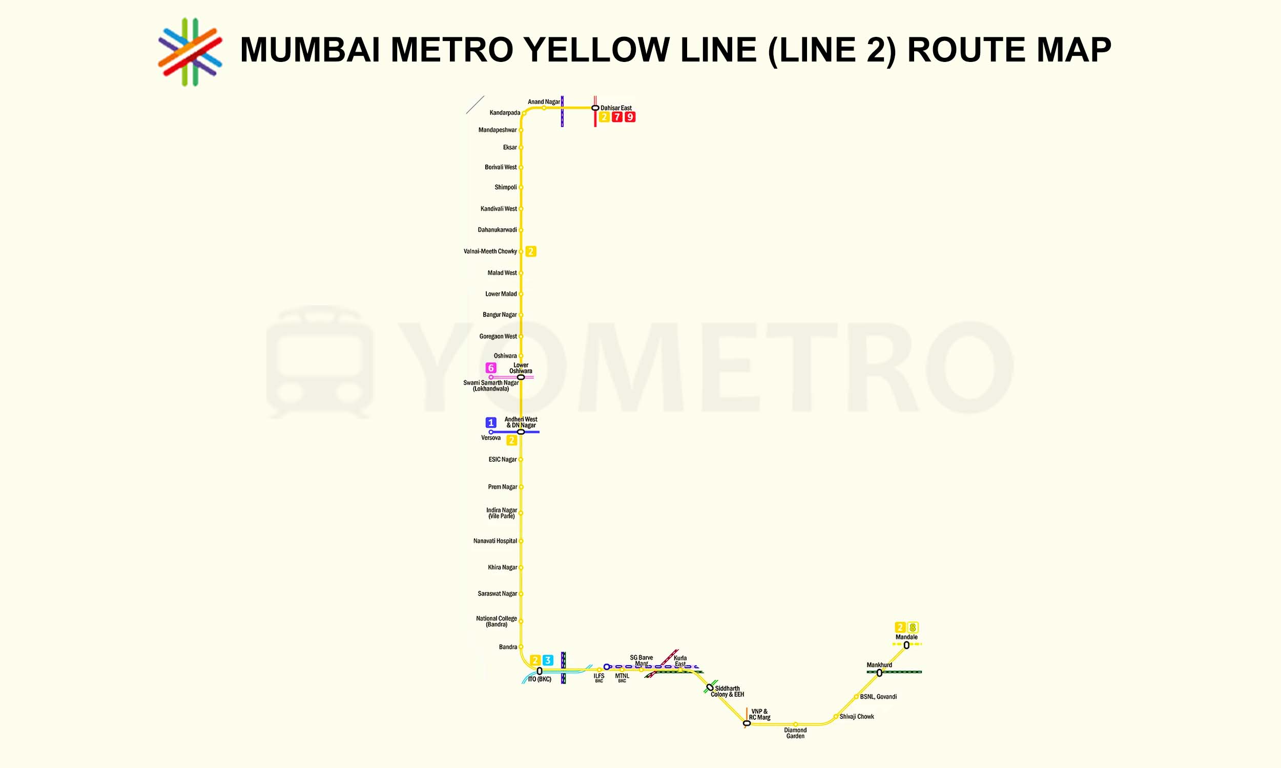
 Mumbai Metro Lines & Network Map
View the complete Mumbai Metro network map with line-wise routes, stations, interchanges, and connectivity details to help commuters and travelers easily understand and navigate the metro system.

Mumbai Metro Aqua Line
Active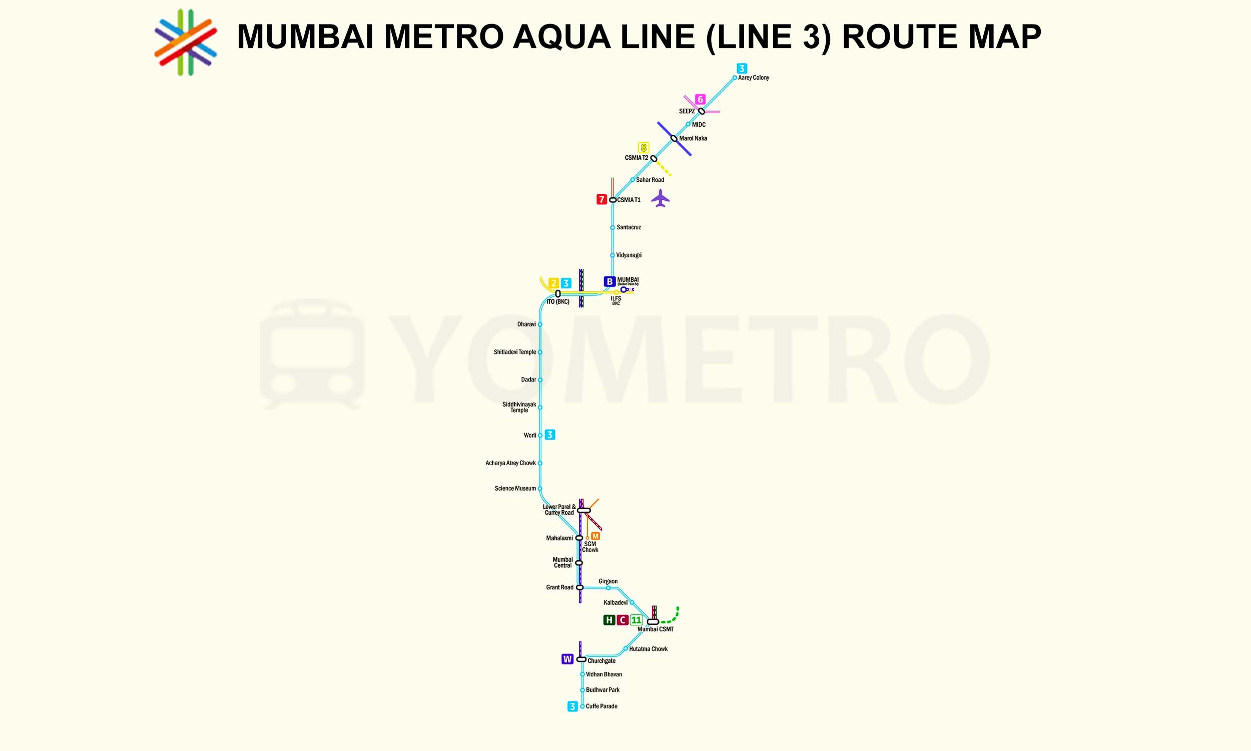
Mumbai Metro Green Line
Inactive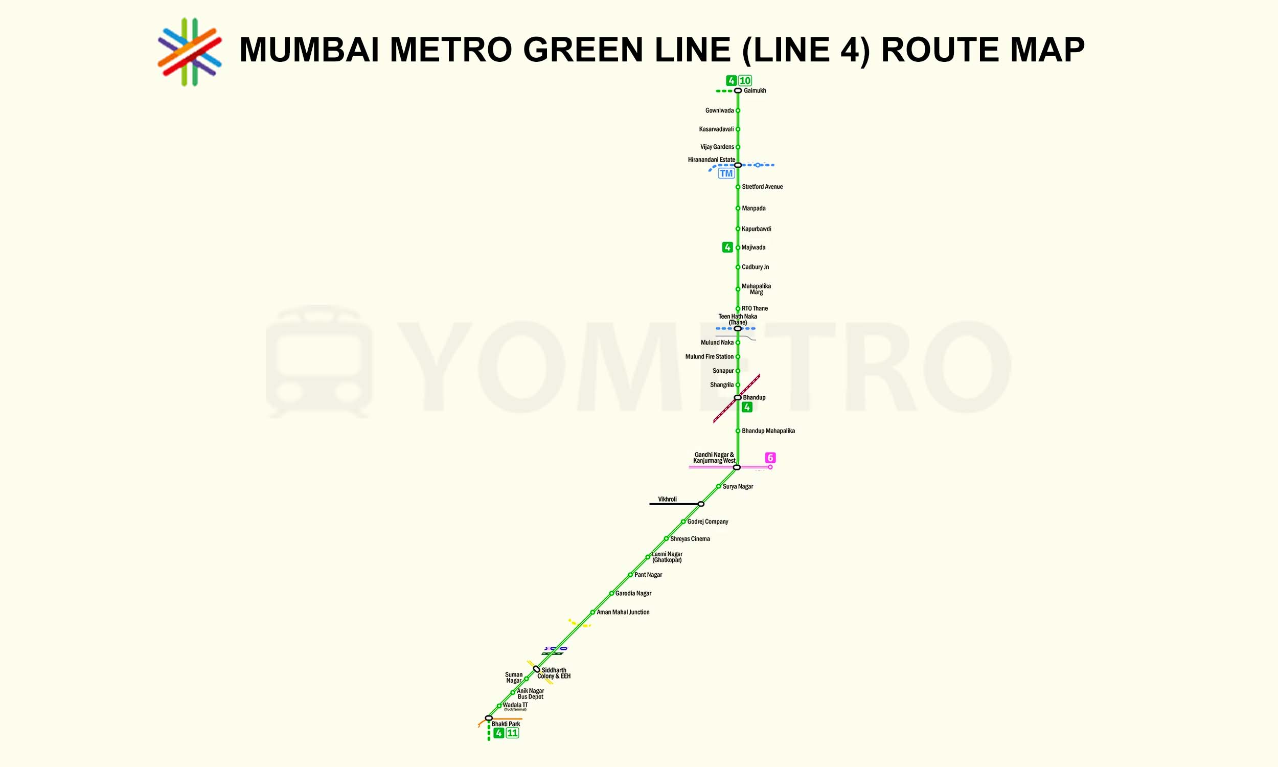
Mumbai Metro Orange Line
Inactive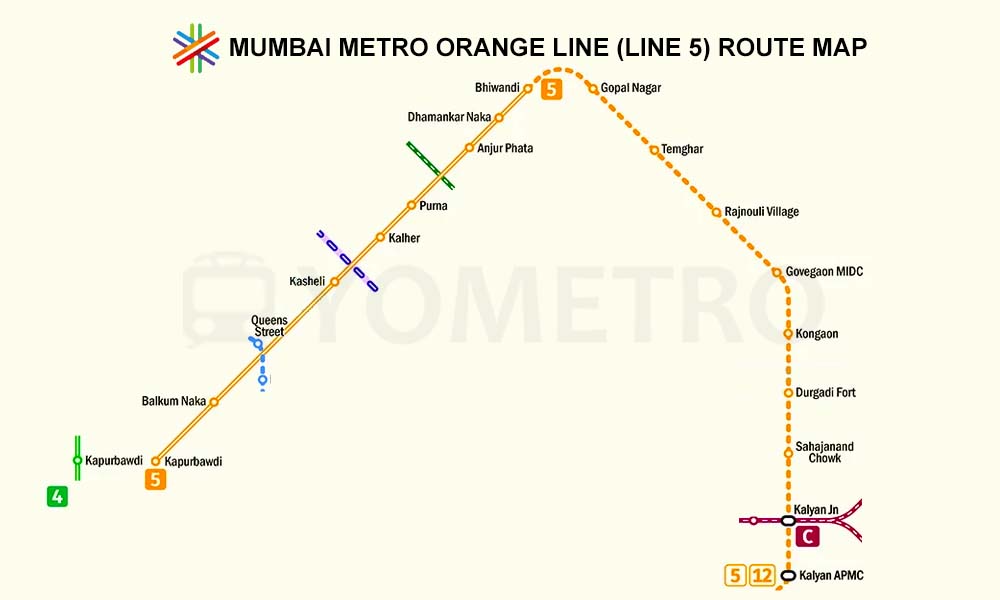
Mumbai Metro Pink Line
Inactive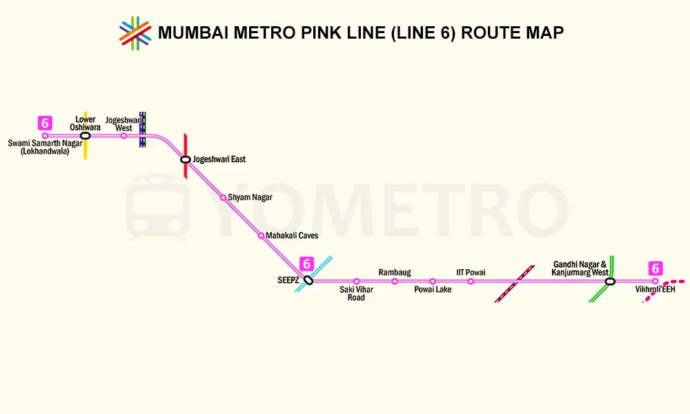
Mumbai Metro Red Line
Active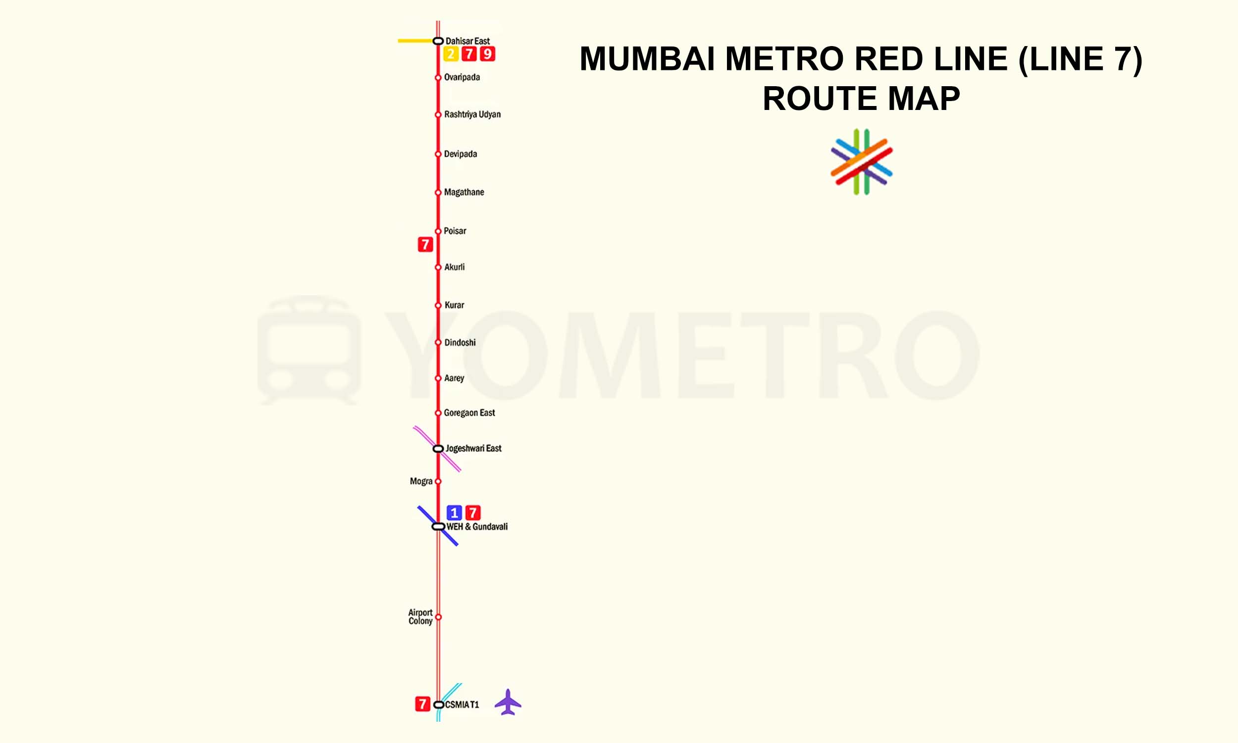
Mumbai Metro Gold Line
Inactive
Mumbai Metro Red Line
Inactive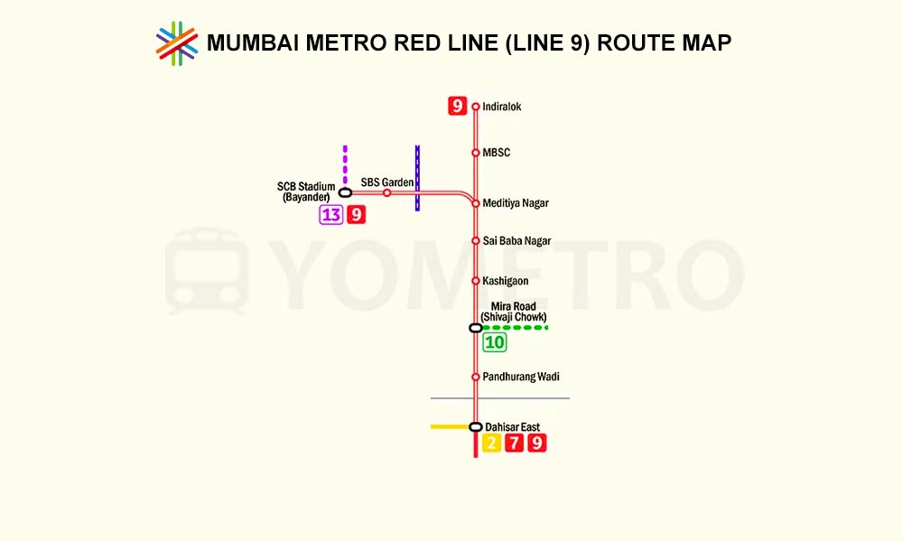
Mumbai Metro Green Line
Inactive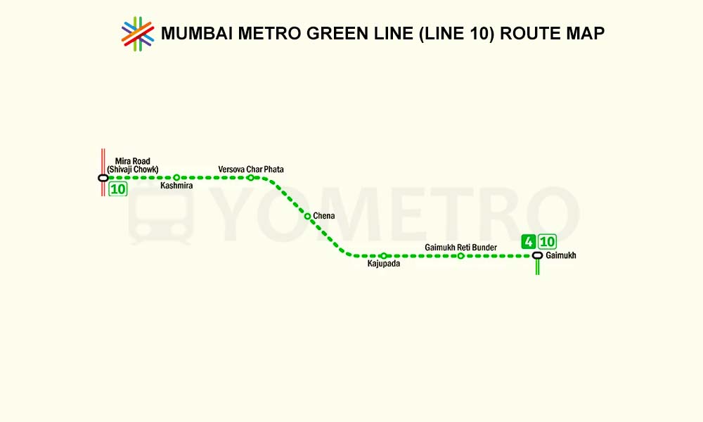
Mumbai Metro Green Line
Inactive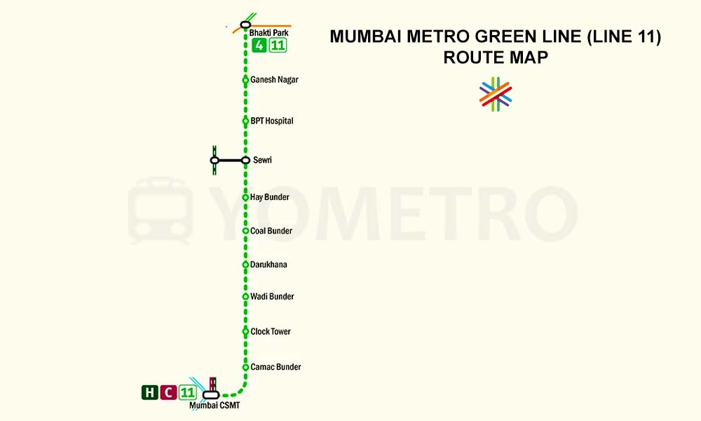
Mumbai Metro Orange Line
Inactive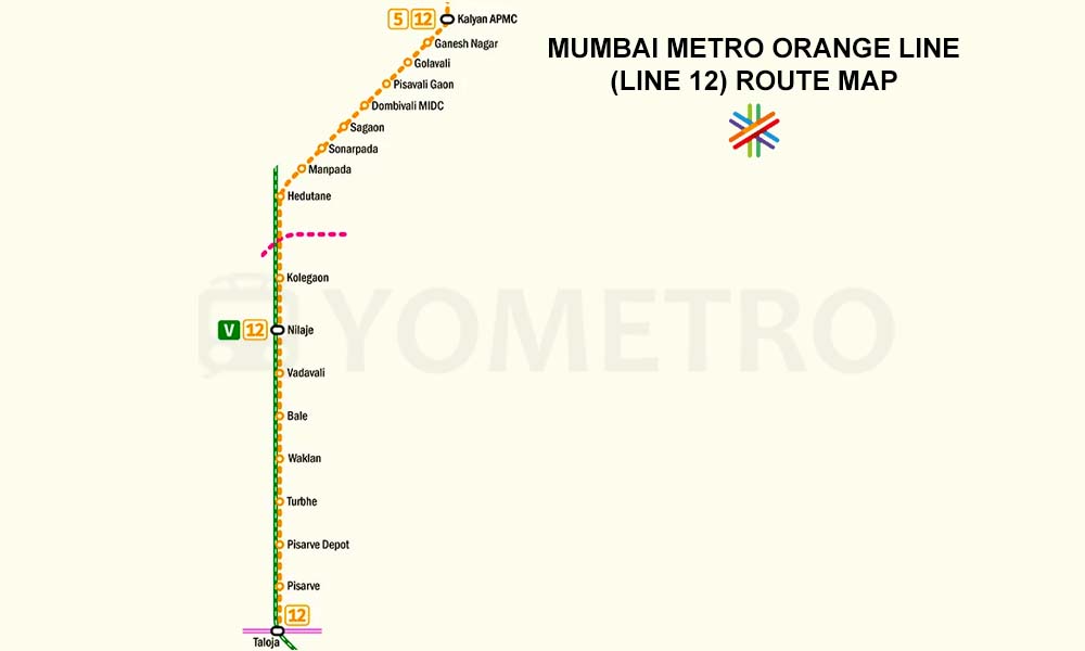
Mumbai Metro Purple Line
Inactive
Mumbai Metro Magenta Line
Inactive
Mumbai Metro Yellow Line
Active
Metro Maps by Network
Explore metro network maps of other Indian cities, featuring line-wise routes, stations, and interchanges to help commuters understand and navigate different city metro systems easily.

