Select Stations to Find Your Route
Mumbai Metro Yellow Line
Total Stations
18 Active / 2 Inactive
Line Length
18.5 km
Line Status
Active
Terminal Station
Dahisar East Andheri West
Mumbai Metro Yellow Line Overview
Mumbai Metro Yellow Line Station List (17 Active)
Status legend: Parking Feeder Bus Bank ATM Sulabh/Restroom
| Active Metro Station | Station Amenities |
|---|---|
| Dahisar East Interchange | . . . |
| Anand Nagar | . . . |
| Kandarpada | . . . |
| Mandapeshwar | . . . |
| Eksar | . . . |
| Borivali West | . . . |
| Shimpoli | . . . |
| Kandivali West | . . . |
| Dahanukarwadi | . . . |
| Valnai | . . . |
| Malad West | . . . |
| Lower Malad | . . . |
| Bangur Nagar | . . . |
| Goregaon West | . . . |
| Oshiwara | . . . |
| Lower Oshiwara | . . . |
| Andheri West Interchange | . . . |
No station under-construction or planned for construction.
Mumbai Metro Yellow Line Map 2026
View the updated Yellow Line map of Mumbai Metro, featuring active stations, under-construction stations, interchanges, and the metro Yellow line route.
Mumbai Metro Fare Chart
Mumbai Metro Yellow Line History, Facts and Expansion Plan
Get insights about the history, facts, and expansion plans of the Mumbai Metro Yellow Line, including details about its development, infrastructure growth, and future improvements in connectivity.
- Line 2 of the Mumbai Metro, popularly known as the Yellow Line, is a rapid transit metro line in the city of Mumbai, Maharashtra, India.
- Mumbai Metro Line 2 from Dahisar East It runs from Andheri West to DN Nagar, covering a distance of approximately 18.6 kilometres.
- It has a total of 17 stations which are Dahisar East, Dahisar, Anand Nagar, Rushi Sankul, Owaripada, Ekta Nagar, Eksar, Don Is Bosco. Shimpoli, Mahavir Nagar, Kamaraj Nagar, Charkop, Malad, Kasturi Park, Goregaon, DN Nagar and Bangur Nagar.
- The section of the Yellow Line was inaugurated by Prime Minister Narendra Modi on January 19, 2023.< /li>
- Further expansion and integration of Line 2 with other metro lines and transportation systems is planned as part of Mumbai's ongoing efforts to enhance public transportation infrastructure.
- MMRDA announced on 15 June 2015 that it would combine the two stretches and implement Line 2 of the Mumbai Metro in three parts – Dahisar East–DN Nagar (Metro 2A), DN Nagar–BKC (Metro 2B), and BKC- Mankhurd (Metro 2C). The plan was later revised to build the line in two sections – Dahisar–DN Nagar (Metro 2A) and DN Nagar–Mankhurd (Metro 2B).
- Metro 2A was inaugurated by the Government of Maharashtra on 6 October 2015. Metro 2B corridor was approved by the Maharashtra Cabinet on 27 September 2016.
- Metro 2B corridor was proposed to be 23.5 km (14.6 mi) long and have 22 stations.
- Metro 2A is 18.589 km long and connects Dahisar East to DN Nagar with 17 stations. . Prime Minister Narendra Modi laid the foundation stone of Metro 2A on 11 October 2015.
- Metro 2B is 23.643 km long and connects DN Nagar to Mankhurd with 20 stations. The foundation stone of Metro 2B was laid by Prime Minister Narendra Modi on 24 December 2016.
- Charkop Depot currently serves as a depot for Line 2A and Line 7. After completion, Mandalay Depot will be used to serve Lines 2A and 2B. There will be a total of 37 stations on Line 2. Metro 2A from Dahisar to Andheri West has 17 stations. Metro 2B from DN Nagar to Mankhurd will have 20 stations.
Mumbai Metro Line 2B (Yellow Line) Extension
Mumbai Metro Line 2B (Yellow Line) is being constructed starting from DN Nagar (Andheri West) to Mandalay (MMR region) and will connect the western suburbs to the eastern parts. The corridor is approximately 23.6 km long and has 20 stations and is being developed in three phases. The project was earlier split as Line 2A (Dahisar-DN Nagar) and 2B (DN Nagar-Mandalay) but later both were combined to be known as a single Yellow Line.
It will provide interconnectivity between the existing Western Express Highway, Eastern Express Highway, Western Railway, Central Railway, Mono Rail, Metro Line 1 (Ghatkopar to Versova) and Metro Line 2A (Dahisar to DN Nagar), Metro Line 4 (Wadala to Kasarvadavali) and Metro Line 3 (Colaba to SEEPZ).
Mumbai Metro Yellow Line FAQs
Find answers to common Yellow Line FAQs of Mumbai Metro, covering stations, interchange points with other lines, timings, travel durations etc.
The Mumbai Yellow Line Metro has several interchange stations from where passengers can transfer to other metro lines. These interchange stations are as follows:
- D.N. Nagar - Interchange with Metro Line 1 (Ghatkopar - Versova)
- Dahisar - Interchange with Line 7 (Andheri (E) - Dahisar (E) corridor)
Mumbai Yellow Line Metro Timings
Mumbai Yellow Line Metro runs on regular schedule throughout the week between Dahisar East and Andheri West.
Mumbai Yellow Line Metro Timings from Monday to Saturday:
- First train: 05:55:00 AM (Dahisar East to Andheri West) | 05:55:00 AM (Andheri West to Dahisar East)
- Last train: 09:24:00 PM
Mumbai Yellow Line Metro Timings on Sunday:
- First train: 05:55:00 AM (Dahisar East to Andheri West) | 05:55:00 AM (Andheri West to Dahisar East)
- Last train: 09:24:00 PM
Mumbai Yellow Line Metro News & Updates
Get the news and updates for Yellow Line of Mumbai Metro, including operational changes, expansion plans, station upgrades, and key announcements for commuters in Mumbai.
The Mumbai Metropolitan Development Authority (MMRDA) announced that Metro Line 5 will now be 34.21 kilometers long, making it one of the largest metro corridors in the entire Mumbai Metropolitan Region. This announcement comes after the approval of a new extension called Metro Line 5A, which adds 11.83 kilometers to the original 22.38-kilometer project.
Preliminary work is about to begin for the proposed extension of the Mumbai Metro 11 line from Wadala to Bandra Terminus via Dharavi. The Mumbai Metro Rail Corporation (MMRC) has begun the process of mapping underground utilities along the route before construction begins. This extension is part of the massive Metro 11 corridor that connects Wadala to the Gateway of India via Nagpada and Crawford Market.
The Government of Maharashtra has approved the extension of Mumbai Metro Line 5A at a cost of ₹4,063 crore to enhance connectivity, providing a major boost to transportation links in Ulhasnagar and its surrounding areas. This new metro corridor will connect Ulhasnagar to Sindhu Nagar Station, thereby fulfilling a long-standing demand of the residents and offering relief from traffic congestion.
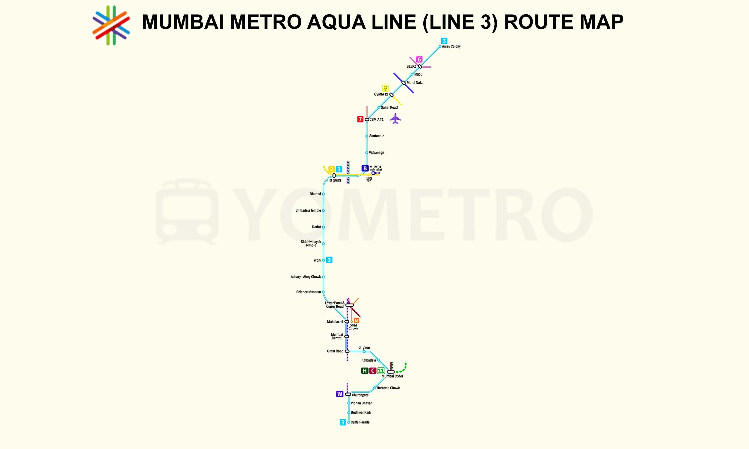
A fire broke out at the underground T2 Airport Metro station in Andheri East, Mumbai, on May 6, 2026. According to officials, passengers were safely evacuated after the incident. Emergency crews immediately arrived at the scene after smoke was spotted in the station premises. The incident, which occurred around 4:10 pm, also briefly disrupted metro rail services on the underground corridor of the Metro Aqua Line 3 between Aarey JVLR and Cuffe Parade.
During the ongoing construction of Metro Line 2B in BKC, a 400-ton mobile crane lifting a prefabricated beam overturned near the Asian Heart Hospital junction due to a mechanical failure. The accident occurred during overnight work by contractor J. Kumar Infraprojects Limited. No injuries or casualties have been reported.
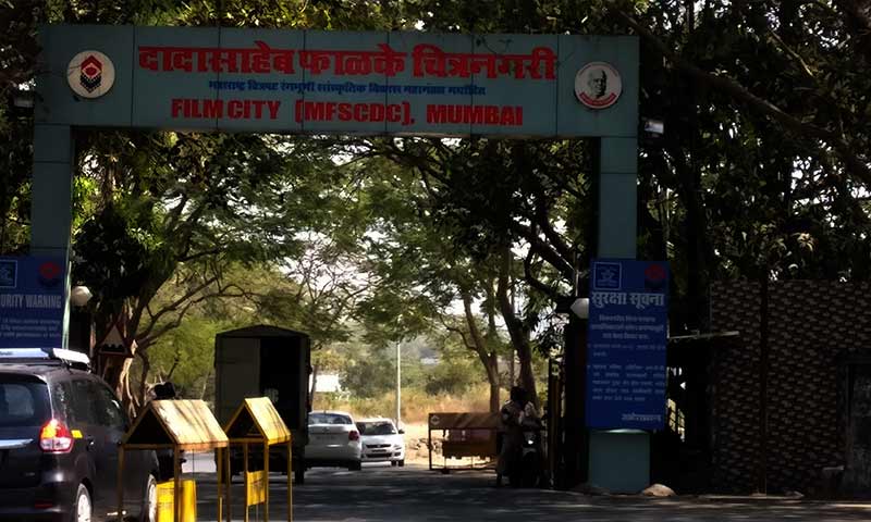
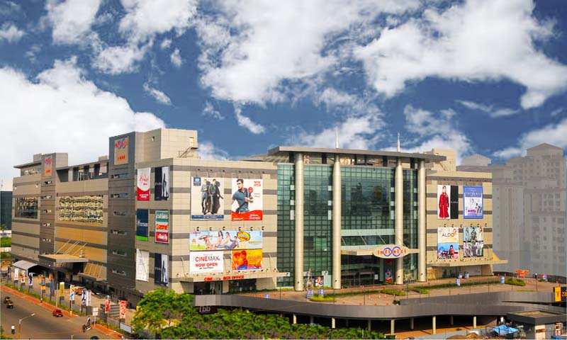
Top Attractions covered by Mumbai Metro Yellow Line
Explore top tourist attractions, popular monuments, cultural sites, and landmarks near the Mumbai Metro Yellow Line, that easily accessible via Mumbai Yellow Line metro.


Saved Routes
Tap Save Route on any route page.